Aerial Data.
Clear Insights.
Better Decisions.

FAA Part 107 certified drone services specializing in orthomosaic mapping, inspections, construction documentation and commercial aerial imagery throughout Northeast Ohio.

Drone data built for commercial decisions.

Useful deliverables, not pretty pictures pretending to be a business strategy. Lumera Drones focuses on repeatable aerial data that helps teams document, measure and communicate what is happening on the ground.


Is Your Aerial Imagery Current?

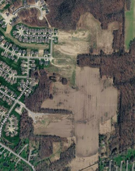
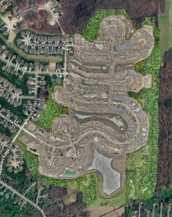
Satellite imagery can provide a useful overview of a property, but it isn't necessarily current. Drone mapping provides a fresh view of site conditions when up-to-date information matters.


Same location. Different date.

Very different picture.

Construction Mapping
Current aerial data to document site conditions, measure progress, and communicate what's happening across the project.

> Orthomosaics
> Site documentation
> Measurements
> Progress documentation
> 3D models/point clouds where appropriate
Progress Monitoring
Consistent aerial imagery captured over time to track changes, document progress, and provide a clear visual record of your project.

> Repeatable flights
> Consistent aerial views
> Documentation of changes over time
> Progress comparisons and time-lapse possibilities
Property & Land Mapping
Detailed aerial mapping to help you understand property features, document existing conditions, and make informed decisions about your land.

> Current aerial maps
> Property/site documentation
> Measurements
> Custom mapping products